


RainSNIP
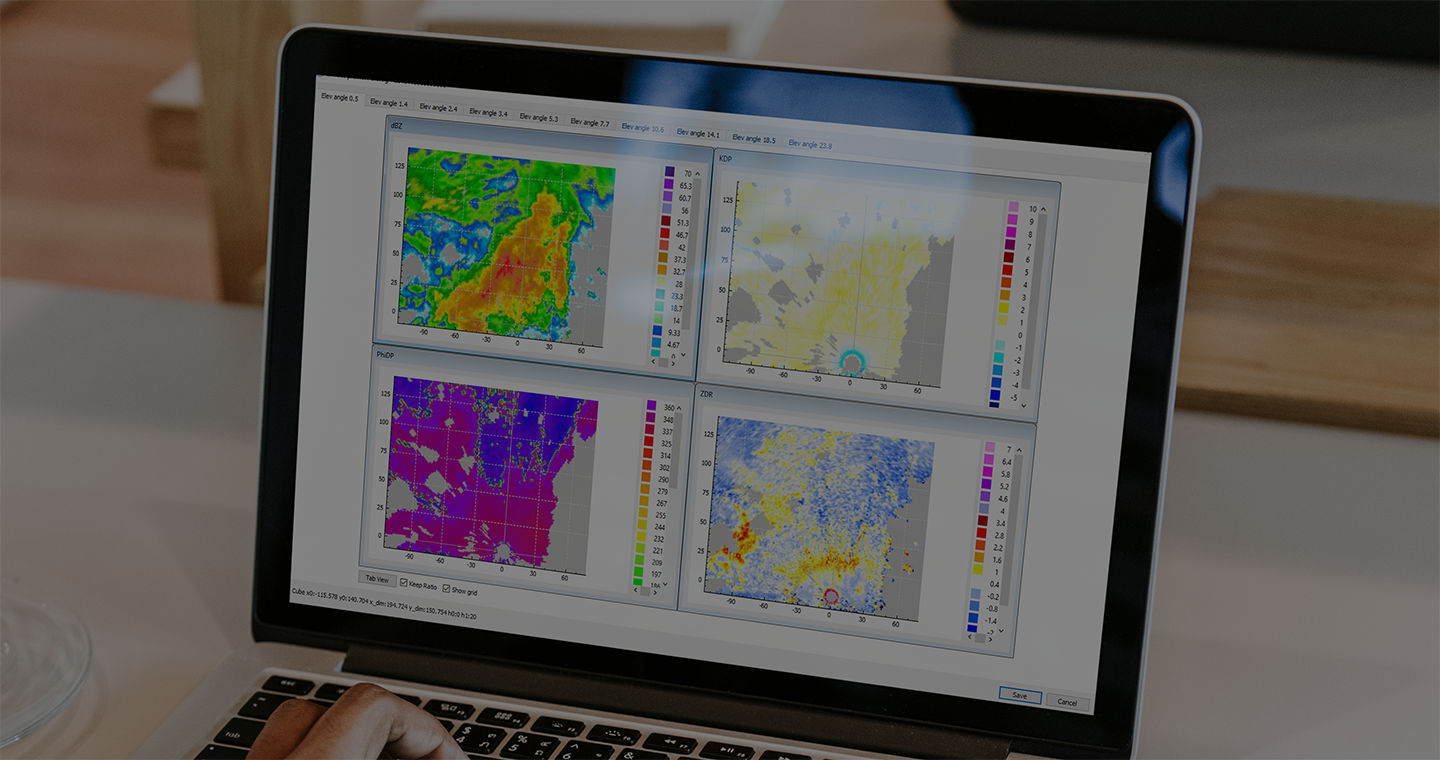
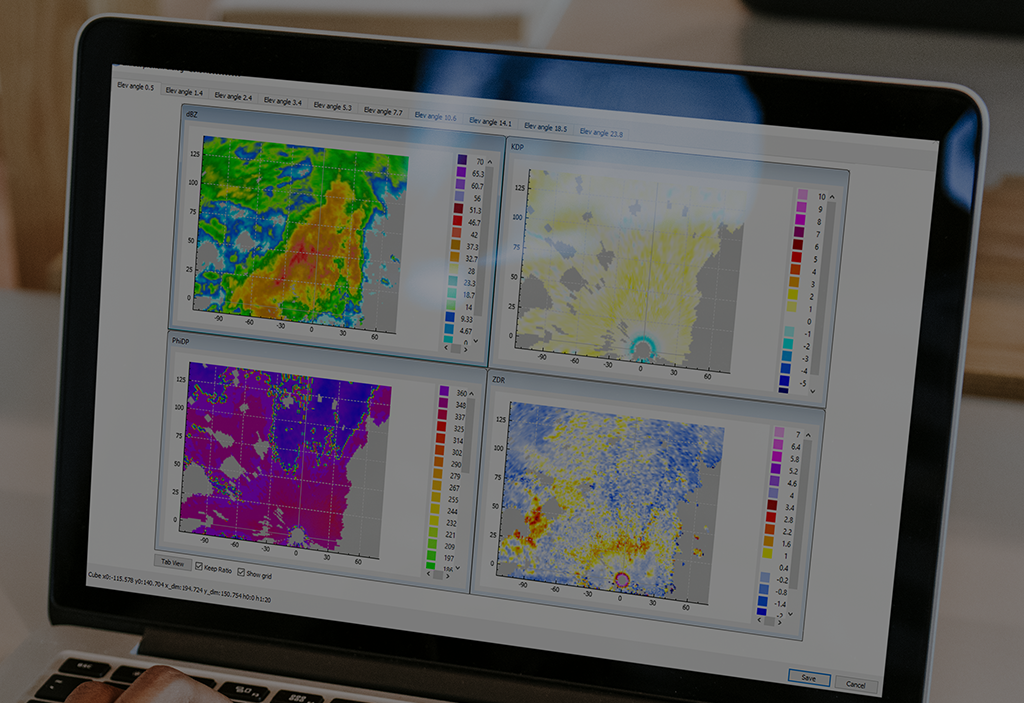
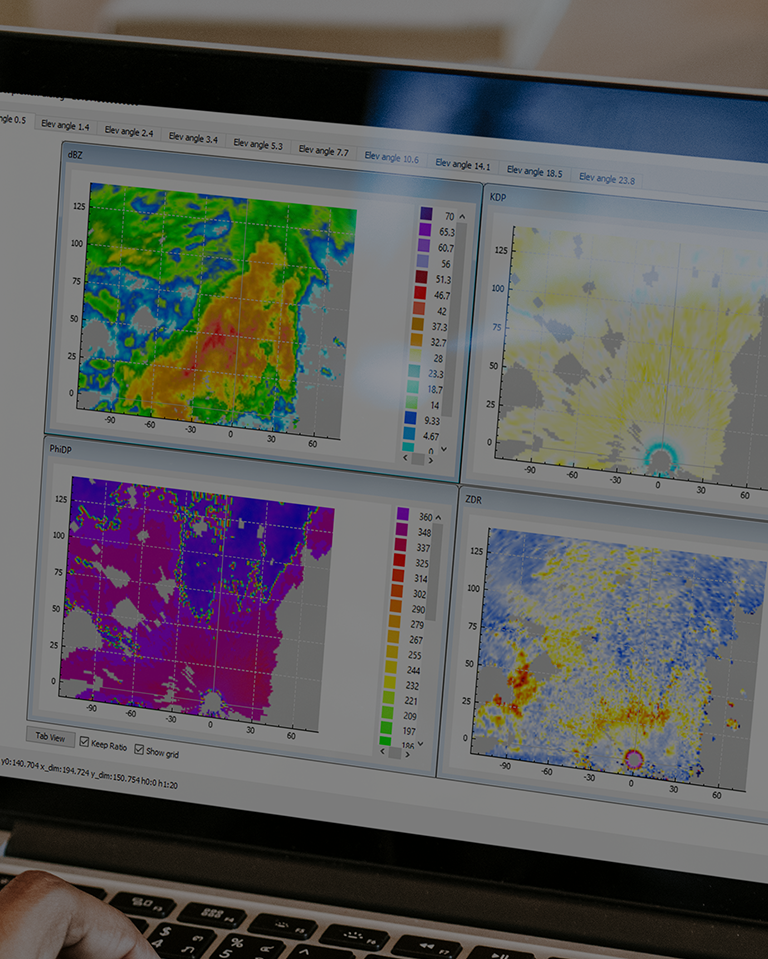
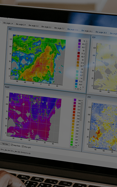
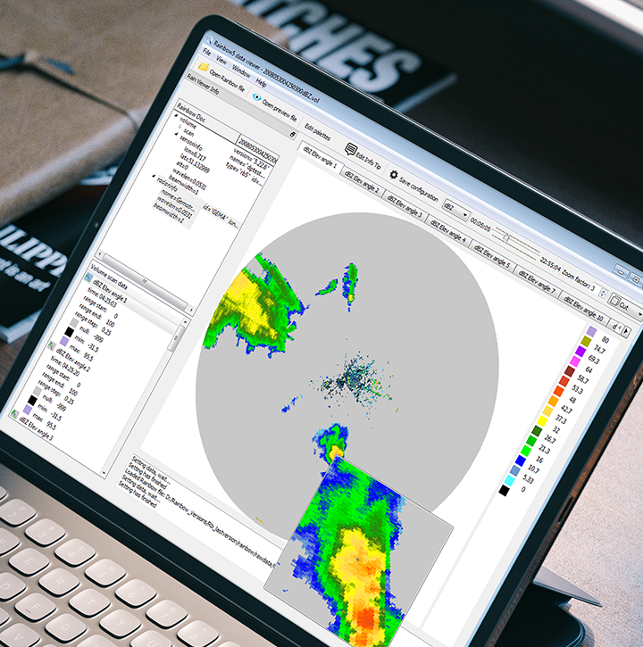
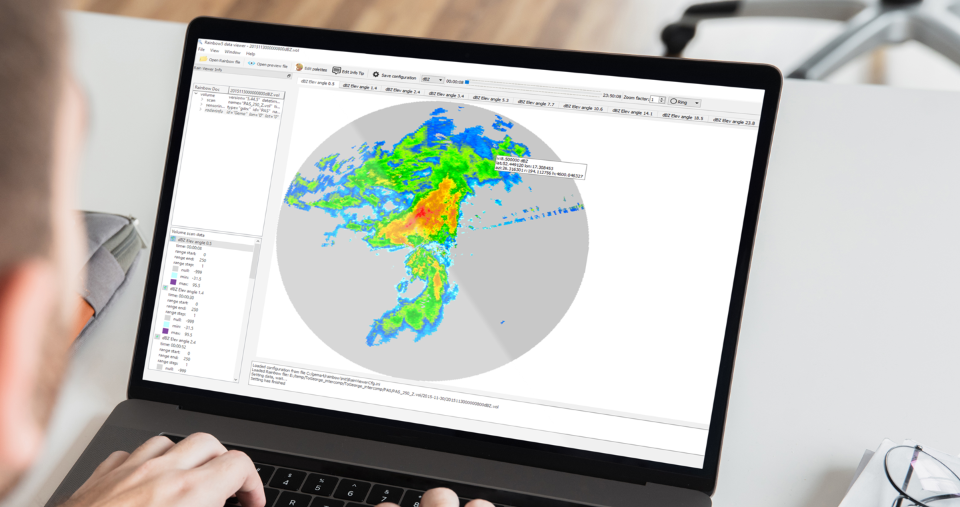
RainSNIP, our tool for scientific radar data analysis and display, is a standalone software package that contains a set of applications to read, manipulate, and display radar data. RainSNIP is available for standard operating systems (Windows and Linux).

The use of weather radar in a network for quantitative precipitation estimation becomes essential for most of the national meteorological services. This requires well-calibrated and coherent radars even in heterogeneous weather radar networks. To meet these conditions and to facilitate the use and the analysis of the radar data by researchers and scientists, Leonardo developed an ensemble of practical functions in the software package RainSNIP.

Main functionalities
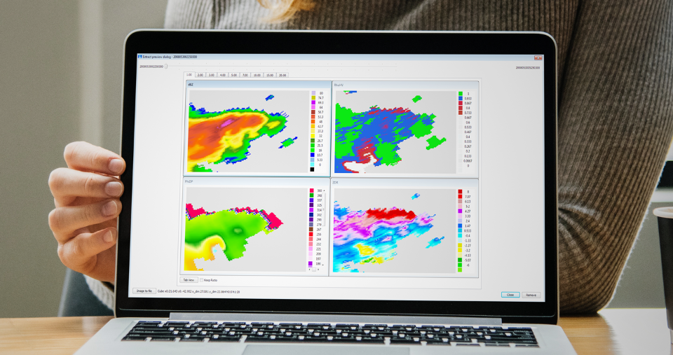
RainSNIP is equipped with a radar data interface, which supports reading polar raw data and key Rainbow® products. A graphical data viewer allows navigating through PPI slices of a volume as well as analysing and extracting data from the full data set to e.g. CSV files. With the RainSNIP radar inter-comparison application, data of neighbouring radars can easily be compared. The RainSNIP data conversion application is suited to import different standard radar data formats. Area selection, zoom, time navigation, data moment selection, data extraction, data query, and geographical coordinates are conveniently handled via mouse cursor.